Touch GIS

Field Data Collection & Mapping

4.0
1 review

3 followers

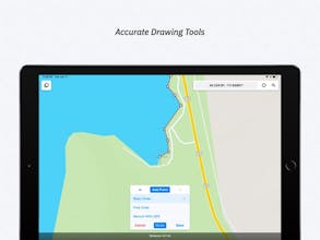
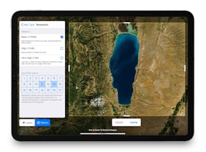
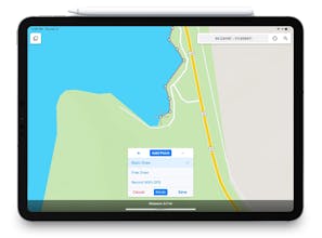
Data Collection & Mapping For The Mobile Era FEATURES - Intuitive Interface - Offline Capability - Map Caching - Robust File Support - Customizable Attribute Forms - Collect Point, Line, and Polygon Features - Custom Feature Classes - Feature Class Templates

Touch GIS gallery image
Launch tags:
iOSMapsClimate Tech
Launch Team

What do you think? …

Harry Donnelly
I think i'll give it a try
Jesse Jensen
Will you have it for android in the future?
Joe @ Touch GIS
@jessehojjensen It is possible but we are currently focused on our iOS products.
Mete
Looks nice, will give a try. I watched the video but I cannot see what makes it as a GIS application? I see only visualisation capabilities.
Joe @ Touch GIS
@mtrcn Hi mete - Touch GIS is primarily focused on field data collection. That data is then typically exported to a desktop system for analysis, post-processing, etc. Touch GIS also supporting importing/exporting a wide variety of GIS-specific formats on a mobile device. GIS is a huge field with lots of applications!

Do you use Touch GIS?