ZENIT Tracks

ZENIT Tracks

Record and view your tracks in 3D Maps, import and export

5.0
1 review

6 followers

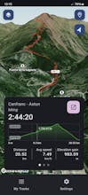
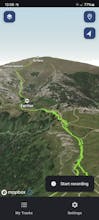
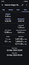
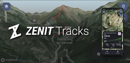
ZENIT Tracks records and shows your tracks in beautiful 3D maps with different styles. You can record your own tracks, or import anyone else's tracks in GPX or KML formats. Export tracks is also supported to GPX, KML, CSV and TCX so you can share them
ZENIT Tracks gallery image
Free Options
Launch tags:
AndroidMapsGPS
Launch Team

What do you think? …

Aner Torre
Maker
📌
I found ZENIT Tracks by looking for an app that allows to record my tracks in the mountain, hiking or backcountry skiing and to show them on 3D maps, so I can easily estimate the difficulty of the track. Exporting the tracks allows me to also see them in Google Earth. I also liked the fact that no account creation is needed to use the app!
Avkash Kakdiya
Congratulations on your Successful Launch of ZENIT Tracks